Pacific Northwest Road Trip Planning Across Washington and Oregon
Integrated itineraries connecting forests, waterfalls, mountains, coastline, and cities
pigeonite.net designs multi-day driving routes that link destinations in Washington and Oregon into single, coherent trip plans. Each itinerary includes daily mileage, recommended stops, accommodation areas, and seasonal notes. Content is built from field research, public land data, and state transportation sources.



Cross-state Pacific Northwest road trip itineraries for Washington and Oregon
Routes connect national parks, waterfalls, coastlines, and cities in unified trip plans
pigeonite.net produces trip plans that route through both Washington and Oregon instead of treating each state separately. Each itinerary includes daily driving segments, lodging towns, trail notes, and current park-service links. Research relies on field drives, USGS maps, NPS alerts, and state transportation reports.
Combined-state routing
14 daysItineraries link destinations across Washington and Oregon in a continuous sequence. Route order is chosen to limit backtracking and keep daily mileage consistent. Each plan notes border crossing locations and Pacific time zone uniformity.
Multi-terrain coverage
Field notesEach trip plan includes temperate rainforest, mountain ranges, waterfalls, coastal areas, and urban stops. Terrain notes cover seasonal access windows, paved versus gravel surfaces, and required recreation passes. Trail recommendations include distance, elevation gain, and trailhead coordinates.
Detailed daily logistics
5 hoursItineraries provide day-by-day schedules with start points, end points, and estimated driving times. Fuel stops, meal towns, and overnight locations are listed with approximate distances. Backup options are provided for common weather closures.
Curated regional resources
Weekday repliesTrip plans reference official park websites, local visitor centers, and ferry schedules. Maps include coordinates for trailheads, campgrounds, and viewpoints. Updates are scheduled after seasonal road reopenings and park alert changes.
Practical travel guidance
Written plansGuides include packing lists, cell-service dead zones, toll information, and reservation deadlines. Wildlife safety and Leave No Trace reminders are included. Condition notes reflect the most recent field research cycle.
Transparent pricing structure
$24Itineraries are offered as single-route downloads or multi-route bundles. Each purchase includes a PDF guide, GPX track, and planning checklist. Pricing is displayed without additional subscription fees.
About pigeonite.net
Travel planning resource for the Pacific Northwest
pigeonite.net was started in 2019 as a documentation project for Washington and Oregon road routes. The website now maintains a library of cross-state itineraries, regional travel guides, and seasonal condition updates. Planning materials are researched through on-site route checks, National Park Service and U.S. Forest Service publications, and state tourism data.

One Trip, Five Landscapes
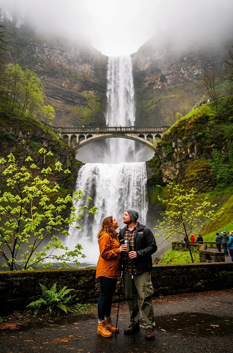
Combine old-growth forests, cascading waterfalls, mountain peaks, rugged coastline, and vibrant cities into one seamless journey.

Expert Local Itineraries
Get researched day-by-day routes built by local specialists, so you spend less time planning and more time exploring.
Transparent Trip Costs
See detailed cost breakdowns in USD, with honest estimates for lodging, meals, park fees, and fuel.

Flexible Regional Routing
Routes are optimized for real Pacific Northwest driving times, weather windows, and easy starts in Seattle or Portland.
Seasonal Condition Notes
Itineraries include monthly notes on road closures, weather patterns, ferry schedules, and trail accessibility based on historical data from the National Park Service, Washington State Department of Transportation, and TripCheck. Updates are reviewed at the start of each season. Sources are cited within each itinerary document.
Cross-State Route Design
Routes are mapped across state lines so that a single trip can include Olympic National Park, the Columbia River Gorge, Mount Hood, the Oregon Coast, and Portland without requiring separate guidebooks. Each route is checked for logical daily driving distances and realistic pacing. The design process uses published road-distance data and average travel-time estimates.
Travel Planning Services
Itineraries, reports, and route consultations for Washington and Oregon
pigeonite.net offers pre-built itineraries, custom route planning, seasonal condition reports, consultation calls, and printed trip packets. Services are structured around factual route data and official land-management sources. Turnaround times and deliverables are described for each option.
Custom Pacific Northwest Road Trip Itinerary
A route plan built from the traveler's start city, trip length, and preferred landscape types. Each itinerary includes a day-by-day driving sequence, overnight town recommendations, daily mileage estimates, and notes on park entry reservations. Typical delivery time is 5-7 business days after receipt of the trip questionnaire.
Price starts at $180 for a 7-day itinerary. Includes route map, lodging list, mileage table, reservation links, and one revision.
Pre-Planned Itinerary Library
Online access to a collection of ready-to-use Pacific Northwest road trip routes. Each itinerary covers 5-10 days and connects destinations in Washington and Oregon. Files are downloadable as PDF maps and include written turn-by-turn notes, stop descriptions, and estimated drive times.
Annual library access is $45. Includes 15+ PDF routes, GPX track files, and monthly condition updates.
Seasonal Conditions Report
A monthly report summarizing road closures, weather risks, ferry schedules, wildfire restrictions, and trail access for Washington and Oregon travel corridors. The report is compiled from National Park Service alerts, state DOT road-condition feeds, and NOAA climate data.
Monthly report subscription is $12. Covers 8 travel corridors across Washington and Oregon.
Route Consultation Call
A one-hour video or phone consultation to review an existing itinerary, discuss route alternatives, or answer logistical questions about Pacific Northwest travel. The call is scheduled through the website and includes a written summary of recommendations within 48 hours.
Consultation call is $75. Includes pre-call questionnaire, 60-minute session, and written summary.
Printable Trip Packet
A physical or digital packet assembled for a chosen itinerary, including large-format route maps, daily stop sheets, emergency contact lists, and packing checklists. Packets are formatted for standard letter-size printing and mailed within 3 business days upon request.
Printed packet is $35 plus shipping. Includes waterproof map, daily sheets, and emergency contacts.
Contact
Reach the pigeonite.net team
Questions about itineraries, services, or route conditions can be sent through the form below. Response time is typically 1-2 business days. Additional contact information is available in the footer.
+15035550110
1211 SW 5th Avenue, Suite 1900, Portland, OR 97204, United States